Passage Planning with Digital Wave
Celestial Navigation
Emergency Navigation by David Burch. i am reading this right now, and i find it an extremely valuable resource to increase the situational awareness of any navigator in any circumstance. Awareness of the stars, the winds, the sea state among other things is very helpful for anyone contemplating a voyage on the sea.
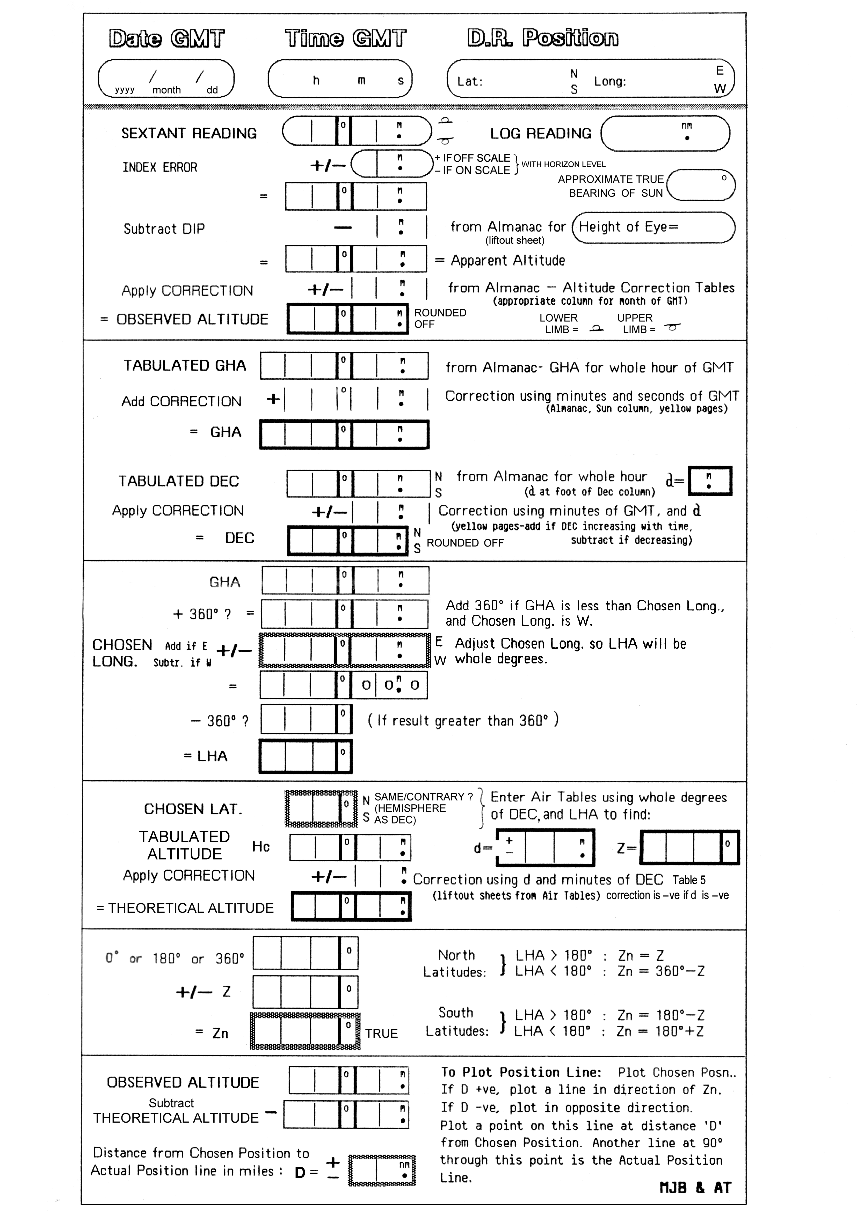
Sight Reduction Sheet courtesy of Malcolm Buchanan and Andrew Troup, 1983
A Short Guide to Celestial Navigation
Piloting
This is a Bowditch classic. All things are rounded off so you can figure things out in your head as you’re passing time on the mid-watch.
Some givens…
Round of a Nautical Mile to 2000 yds.
D = Distance
S = Lateral Separation
A = Angular Difference in degrees
D/60 = S/A
DA/60 = S
etc… you can form it to fit your purposes.
Situation 1. You’re 6 miles from your next port sailing due North. The wind shifts and you have to sail 010. How far off course will that make you.
S is what we’re figuring out. So (6 x 10)/60 = 1 nm. Use whatever units for distance are handy, just keep it consistent.
What’s really handy about that is that when you’re doing some “what if” work when trying to reach a destination, just figure out the distance for 1 degree. So the distance divided by 60. 6 miles = 12000 yds. 12000/60 = 200 yds. Then as you choose your course you can multiply by the degrees off course. If you can only make 015, you have 15 x 200 yds = 3000yds – 1.5 NM.
Situation 2. Turn that around and make is something you want to avoid. We’re looking at the chart and see that the lighthouse on the starboard bow at 030, 3 miles away, marks a point with hazardous waters. Lets say we want to give it wide berth and stay 1000yds (half mile) from the thing. You can get the plotter going or just do some quick head math.
3 Miles = 6000 yds. Divide by 60 = 100yds separation for each degree off of 030. 1000yds desired separation divided by 100 yards per degree = 10 degrees. So we need to steer 020 or left of that to stay clear .
Sure it’s not all 6 and 12 mile figures, but with sailing there’s usually time for a little long division in your head. Also this gets less accurate as the angle gets larger because in reality each degree would be slightly larger separation. But under 45 degrees angle the difference is negligible and we’re just trying to get in the ballpark.
COLREGS Summary and Action Chart
Online List of Navigational Charts and Guidebooks
Tides and Currents at DeepZoom.com
Free Online Navigation Course – The old fashioned way
Navigation Rules Practice Test – Test your knowledge in the safety of your home.
Open CPN and Open Plotter
Aqua Map Up and Running in 3 Steps
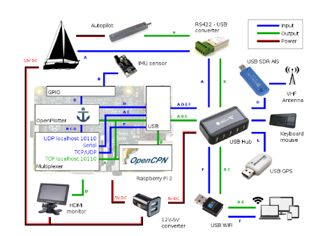
Detailed Raspberry Pi Setup Open CPN
Colregs and Buoyage
Handbook of the Nautical Rules of the Road
COLREGS Summary and Action Chart
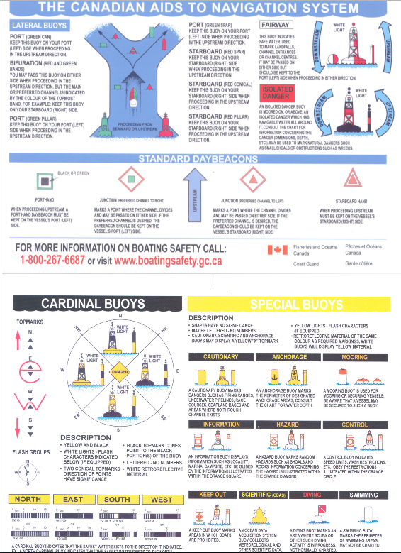
Canadian Coast Guard Buoyage System
Online List of Navigational Charts and Guidebooks
Neptune Planner Navigation App
Racing Rules
Guide Books and Pilot Charts
Free Cruising Guides to the Caribbean – Includes a section on security in port – Includes ads. There is a whole lot of information in the section on the DR. Culture, what to expect from the officials, prices to pay for “tips”, and what things are legally required. Check it out!
A Cruisers Guide to Cape Breton Island
Coast Pilots – Atlantic Canada
Zuluwaterways – Crowd Sourced Info for the Boat Captain
Fremantle Sailing Club Cruising Guide to the Australian Bight
Jimmy Cornell’s “Where Do All the Boats Go?”